


Drone Surveys
Omni Design Inc. has over 30 years of experience performing land surveying services throughout the state of California.
Our strengths are our ability to combine our licensed land surveyor’s expertise with state-of-the-art equipment and computer software to produce surveys, maps, laser scans and As-Built plans of the highest quality.
We pride ourselves on providing profound expertise that is reflected on the high-precision products we deliver to our clients that meet local land laws and regulations.
The markets we have served over the years include residential, industrial, commercial, telecommunications, fiber optics, land development, and public infrastructure projects.
Land Surveying
- Boundary survey
- Right of way surveys
- Construction Staking
- Verification surveys
- As-Built surveys
- Certifications (flood, height, setbacks, foundations)
Mapping
- Topographic Maps
- American Land and Title Association Surveys (ALTA)
- Record of Survey maps
- Subdivision mapping (tentative maps, final maps, tract maps, lot line adjustments, easements)
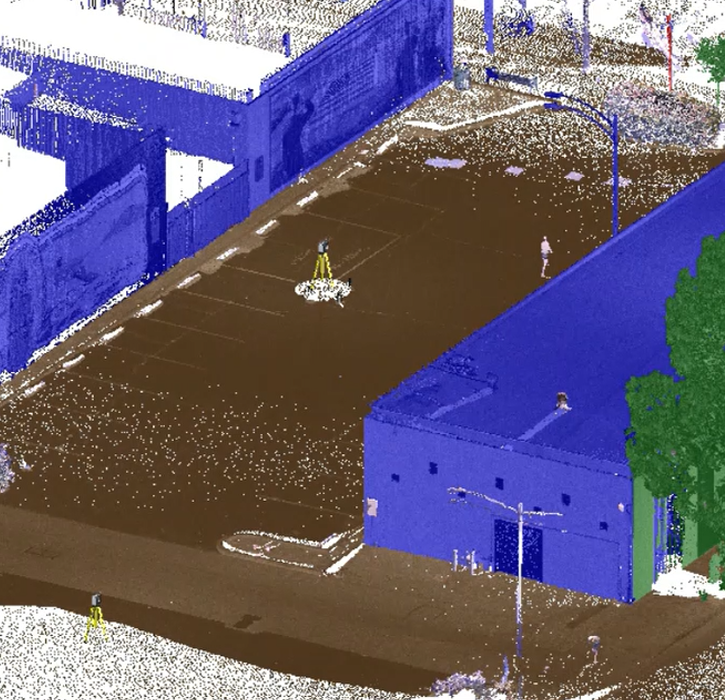
Laser Scanning (LiDAR)
- Point-Cloud Data models for virtual visits
- As-Built Plans (interiors and exteriors) of existing infrastructure
- Spatial analysis of existing conditions
- As-Built BIM models or CAD plans
Drone Surveys
- Ortho Photos
- Topographic Surveys
- Timeline videos
- Earth Quantity Take offs
Project delivery
- Design-Build
- Design-Bid-Build
- Job order contracting
Clients
- Architects
- Land developers
- Realtors
- State and local agencies
- Lawyers